
Creating a map geared towards bike transportation is a challenging task, but a relevant one. With an urbanizing, mobile population and a growing need to find fast, efficient, and cheap alternatives to automobile transportation, effective communication of bicycle routes and associated bicycle-friendly infrastructure is becoming more important. The major problem is that most bike maps, due to the nature of their content, easily get crowded, cluttered, and hard to read. This requires a paradigm shift, and finding where the happy medium of effective content and supplemental information exists. This post is the first in a series that will discuss what cartographic characteristics make an effective bike map. We will ask and attempt to answer a number of questions, and then provide a high level survey on the state of bike maps while suggesting some optimal solutions.
On the vast spectrum of viable transportation choices, a bicycle is one of the few options that is not a motorized vehicle but still allows for a large amount of personal mobility and freedom. Less intrusive than a scooter or moped, more practical than a skateboard or rollerblades, a bike fits somewhere in the vicinity of half car/half pedestrian. A bicyclist can go just about anywhere with only a handful of limited restrictions, but can also effectively flow with automobile traffic down major roads, and when doing so must follow the rules of the road (Ever gotten pulled over for running a red light on a bike?). But a bike is not a car, and the flexible nature of biking and lack of exclusive bicycle infrastructure in most urban areas make creating an effective bike map a challenging task that remains open to much interpretation and subjectivity. You can see this in the handful of bike maps in the illustration below, where as opposed to a traditional road map, it becomes very hard to intuitively distinguish what each feature is.
 So this begs a number of questions. Does a holy grail for how to create the “perfect” bike map exist? What kinds of wayfinding tools can address this and direct bikers towards efficient and safe navigable routes? With the large amount of interpretation, subjectivity, and non-exclusive use bicycle infrastructure, what criteria can be defined that will refine content and make the ideal bike map?
From a design perspective the best way to address these questions is to simplify them, and of course ask a few more. What is important to a cyclist? What do they need to navigate? What features on a map are necessary to facilitate the most efficient bike transport? Where are they trying to go? Are riders commuters or recreational? The following are three important considerations in bike map design that help answer these questions, each important in its own right. They include knowing your community and its infrastructure, rethinking your design hierarchy, and awareness of technologies that might provide the most effective ways to convey your map and its content to the user.
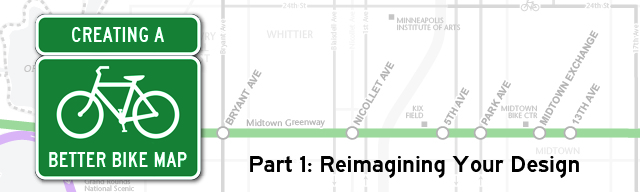
1. Know your community and it’s infrastructure

Midtown Greenway “Bike Highway” – Minneapolis
Perhaps the most important component of effective bike map design is knowing your local community. Specifically, knowledge on the extent, location, and quality of the physical bicycle infrastructure in the region, along with familiarity on the users of that infrastructure (commuters? recreation? both?). Spatial data on bike routes and trails, if it exists, is rarely kept in a single central location and is often maintained by a number of different organizations, ranging from local park board websites to state natural resources offices. Collecting it and customizing it to your needs and the needs of the cycling community is not a simple task. Physical bicycle infrastructure can include grade-separated routes, off-street bike trails, on-street bike lanes, designating cycling streets, and bike boulevards. In addition to these features, the designer must be also be aware of features that may not be clearly distinguished in existing spatial dataset. Determination of other bicycle-centric features, such as service stops, bike shops, and parking locations, will require some subjective distilling of information from existing geographic data. To complicate things a bit more, many cities around the world are diligently investing in bike infrastructure and facilities are changing at a rapid pace. Ensure the map is easy to update, and note where new and future bike infrastructure exists or is under construction.
2. Redefine your visual hierarchy
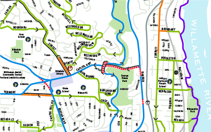
Portland, OR – Lesser important roads de-emphasized, but color scheme still unclear.
Bikes are not cars. A biker does not want to be riding down a major thoroughfare, nor does the rider want to be biking in areas with many natural, physical obstacles that may be irrelevant to those in a car. This requires reimagining your city and viewing it from the paradigm as if the major car-centric features are not there, or exist as notable landmarks and navigation points rather than a network of routes. Certain features that are important on a road map lose importance, for example, you cannot bike down an interstate. The interstate however will likely remain an important feature to include as it will give your readers context and a benchmark for navigation. Redefining the cartographic hierarchy will perhaps radically change the appearance of maps of the region, as different features than are normally called out are made to look more important, and defining features on other maps are given lesser emphasis. Krygier and Wood provide a well written summary of intellectual and visual hierarchy here.
3. Determine the map capabilities and means of distribution
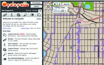
Cyclopath: OpenStreetMap for Biking
Also important is the means by which the user consumes the map, for example, a cyclist likely won’t use a map that only works effectively on his desktop computer at the office. This of course makes either mobile device based maps or paper maps the optimal means of conveyance. It must be considered that most bikes don’t have on-board navigation nor will they using their cell phones while they ride (I’ve tried, doesn’t work out well…), but many users will still have cell phones with them or have backpacks or pouches for clean, clear paper maps. The user won’t have constant access, but instead require sporadic access on demand. Turn by turn navigation is an interesting topic here, and some mapping giants have attempted this (see Google maps). They have had varying success, due to scarce standardized data and the lack of addressing a true means to reach the rider while he/she is biking. As mentioned above, making the map easy to make changes and update is important, as data changes rapidly as infrastructure grows and changes. One interesting attempt to address this, as well as collect an incredible amount of data, is community sourced biking mapping, a method used in projects like Cyclopath, which could be viewed as an OpenStreetMap exclusively for biking. Compare and contrast it to the Google bike maps.
There are a growing number of resources on bike maps out there, and most cities now maintain, or plan to maintain, bike maps for commuters and recreational riders. This post is the first of a short series on creating effective maps for bike transportation that will focus on design criteria and methods of a good bike map, survey, evaluate, and categorize a selection of bike maps, discussing what works and what doesn’t, and finally outline the creation of a new but perhaps familiar style of bike map from concept to completion.

A snapshot of The Minneapolis Bike Freeway System map – (c)2013 Graphicarto
Happy Mapping,
-Mike