
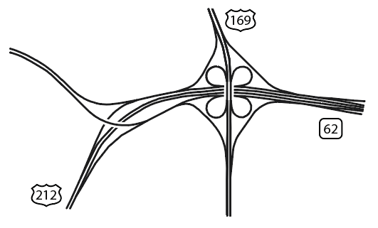
US 169/212/Hwy 62 – Minnetonka/Edina/Eden Prairie, MN
Like many cartographers, I’ve always had a certain fascination with urban form and geographic patterns. Out of seeming chaos, patterns and systems are found, governed by common practice, understood convention, and cultural norms. Urban patterns can be found on both micro and macro scales, from a grid of streets to a facade of windows. While perusing maps and working on another project, I noticed a ubiquitous feature in the urban landscape, the cloverleaf interchange. Inspired by some beautiful recent work by Cedric Francois (Interchange Choreography) and incredibly interesting work in identification of urban patterns through image processing of aerial photography by Terrapattern, I dug in a bit more.
The cloverleaf is a bit of a relic in transportation planning. They flow freely with lower traffic, but as the facility nears capacity, the required lane weave can cause significant backups and delays. Traffic traveling through the ramps has to be limited in speed to prevent rollovers, and they consume more space than many intersections that incorporate flyover ramps. That said, they remain cost effective solutions in many regions.
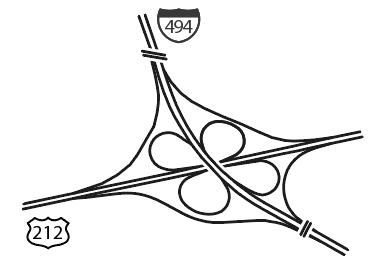
I-94/US-212 – Eden Prairie, MN
While not distinctly Minnesotan, transportation planners in the Twin Cities of Minneapolis and St. Paul have been particularly fond of the cloverleaf. Perhaps its the frugal, modest Upper Midwest ethos, or simply the fact that many of these interchanges were designed in the 1960s and 70s, but if you count them, there are 31 cloverleaf interchanges in the greater Twin Cities metropolitan region. This number doesn’t include interchanges formerly arranged as cloverleafs, but at some point converted to another design. There are at least a handful of these scattered around the city, some of which more disguised than others.
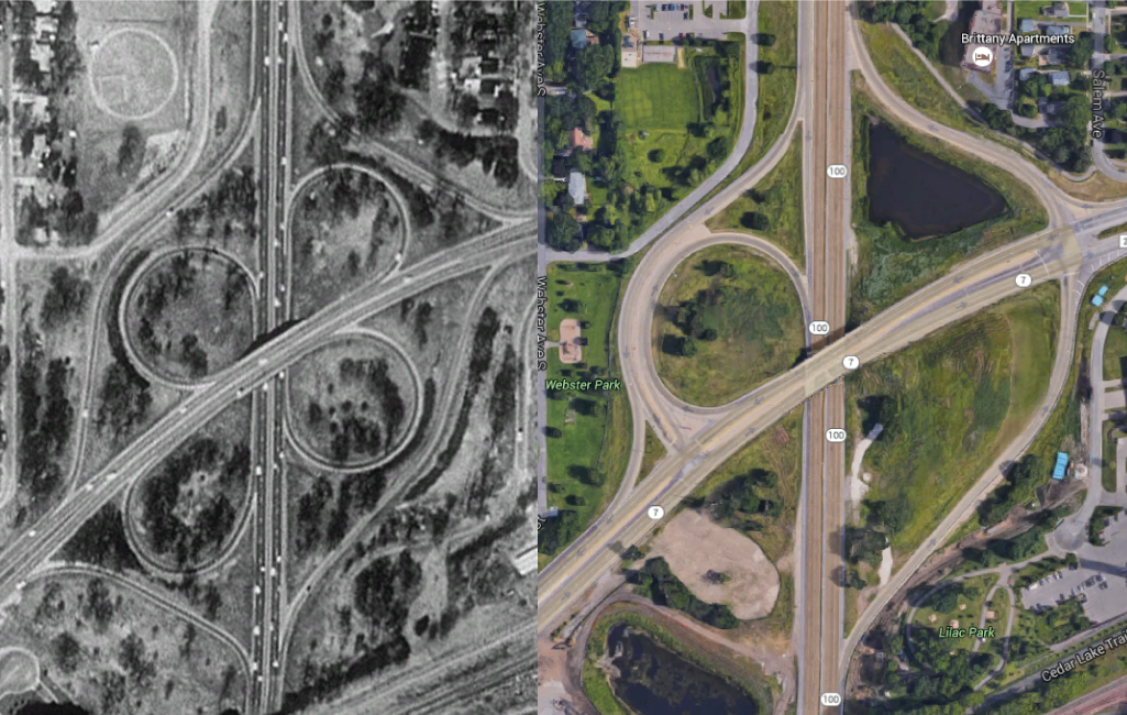
1991 (left) to 2016 (right) – Former Cloverleaf – Hwys 7/100, St. Louis Park, MN
All considered, the cloverleaf interchanges from above can be strikingly beautiful. The patterns of them are not revealed to the driver on the ground, but only from the sky. Grabbing data from OpenStreetMap, I mapped the linework of all interchanges in and around the Twin Cities metro that could be considered at least a three-leaf clover, if not a four-leaf clover. The interchanges range from symmetrical to sweeping, simple to incredibly complex. A few follow, see the poster at the bottom for a snapshot of all of them.
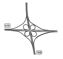
TH-610 and US-169

I-694 and I-35W
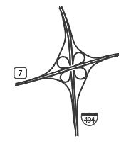
I-494/TH-7
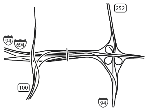
I-94/694/TH-100 – Brooklyn Center, MN
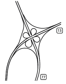
TH-13/77 – Eagan, MN
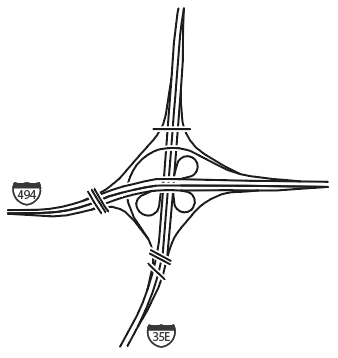
I-494/35E – Eagan/Mendota Heights, MN
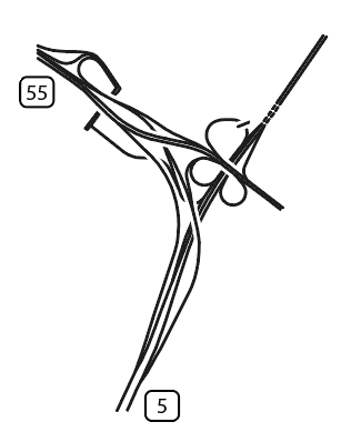
TH-5/55 – Fort Snelling, MN
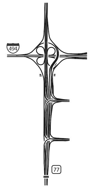
I-494/TH-77 – Bloomington/Richfield, MN

Happy Mapping!
-Mike