Featured post

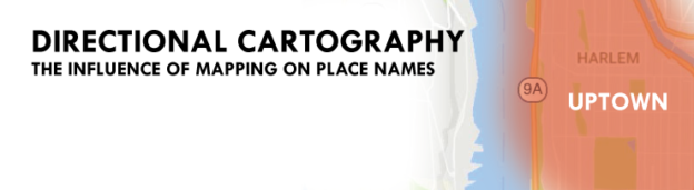
Directional Cartography: Maps and Relative Direction

Map orientation shapes perception of the world around us It’s pretty common to describe direction in relation to location on a map. Go up that way, down here, or over there. Up, down, and over are relative directions given from a point of reference, often physical topographic change. Up river, down the hill, and over Continue reading… »

Featured post

Urban Patterns: The Cloverleafs of MSP

Like many cartographers, I’ve always had a certain fascination with urban form and geographic patterns. Out of seeming chaos, patterns and systems are found, governed by common practice, understood convention, and cultural norms. Urban patterns can be found on both micro and macro scales, from a grid of streets to a facade of windows. While Continue reading… »

Featured post

Mapping Twin Cities Neighborhoods

Drawing a map of the city based on how we live in the city What makes a neighborhood? Many things may come to mind… including the people you live with, the places you frequent, and the locations you call home. Neighborhoods are the physical locations in which people connect with the city in which they Continue reading… »

Featured post

Nine Habits of Effective Designers

“It is not about how much information there is, but rather how effectively it is arranged.” -Edward Tufte It’s only appropriate to start a post on design with an Edward Tufte quote, I suppose. That said, I often find this quote very appropriate when faced with a challenging design task. It can be easy to Continue reading… »

Featured post

The Lost Art of Critical Map Reading

In a world of budding novice mapmakers and shares, likes, and retweets, we have never seen maps and graphics appear, circulate, and educate as much as they do right now. Maps are an engaging way to visualize data and gain knowledge.  Geovisualization, cartography, and analysis are not only relevant, but highly visible to the mainstream, Continue reading… »

Featured post

The Land of Coding: Cartography and the Embrace of Technology

Somewhere in the past few decades, cartographers have lost the control of cartography. How could this happen? Can we get it back? This past fall, I co-taught an introductory GIS and Cartography class in a department of future urban planners. Many great questions were brought up and discussed through the duration of the course, some Continue reading… »

Featured post

Mapping Urban Growth: A Cartoanalysis

A catalog of maps, large or small, is a treasure trove of information. A collection that when sitting static is still always growing and always changing. Everyday its value as a temporal benchmark of human growth and innovation increases. The map itself is a snapshot of place and data (or at least a window into Continue reading… »

Featured post

Cognitive Cartography: Transit Map Style

Cartographers have long had a quirky, and sometimes strange, fascination with transit maps. Since the days of Harry Beck and the first London Tube maps, an entire cartographic subculture has grown around them. No longer just limited to metropolitan transit systems, authors and map creators now use them to represent everything from river systems to rock ‘n Continue reading… »

The Baseball Map: Who’s in town today?

Mapping Out the 2016 Baseball Season Visually tracking your team, and who and when they are playing, during a 180 day pennant marathon can be tricky… team schedules tend to be decentralized, tabular, and kind of boring. The aim of this map is to provide a visual schedule of the season, giving easy access to Continue reading… »

Geography for the Non-Geographer

Geography, the science and study, is wide reaching, cross-cutting, and diverse. Spatial concepts, geographic fundamentals, analytical methods, and data maps are helpful or even critical in many disparate fields, see applications in Urban and Regional Planning, Environmental Studies, Public Health, Geology, Architecture, Journalism, and Civil Engineering. As fields of study, Human and Physical Geography, Cartography, Continue reading… »

The Place of Process: Tools and Importance of Procedure

One of the most important characteristics one can possess in the current professional landscape is the ability to learn new tools quickly. This rings true across many industries, and is especially relevant in the spatial field, where the advancement of cartographic tools and web-based techniques for spatial data visualization, data collection, analysis, and public distribution Continue reading… »

Minneapolis: Then and Now

So I stumbled across an old postcard of Minneapolis, taken of the skyline probably in the mid-1960s. I was immediately struck by how close it was to a photo I took earlier this year (late March 2013, obnoxius chain link fence on the Franklin Ave bridge and all).  The growth of the city core is Continue reading… »